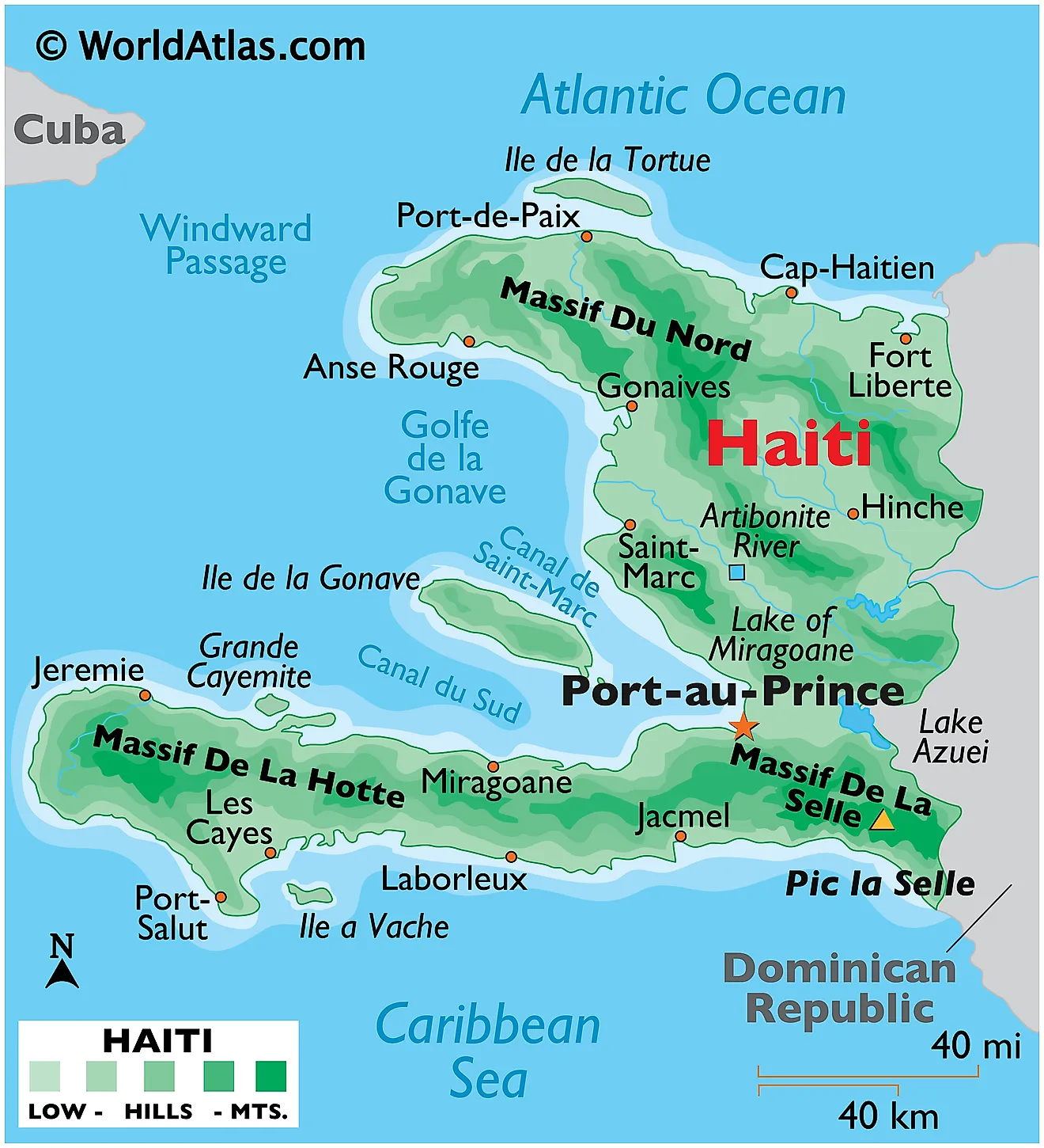
Haiti, located on the western part of the island of Hispaniola in the Caribbean Sea, is characterized by diverse geography, a tropical climate, and a rich natural environment.
Geographical Features:
- Mountains and Terrain: The landscape of Haiti is dominated by mountain ranges and highlands. The Massif de la Hotte and the Massif de la Selle are two major mountain ranges, with Pic la Selle being the highest peak in Haiti, reaching an elevation of about 2,680 meters (8,793 feet). The rugged terrain contributes to the country’s susceptibility to landslides and erosion.
- Valleys and Plains: Between the mountain ranges, there are valleys and plains where most of the population resides. The Central Plateau is an important agricultural region, and the Artibonite Valley is known as the “Rice Bowl” of Haiti due to its fertile land.
- Coastline: Haiti has a coastline that stretches approximately 1,771 kilometers (1,100 miles). The country’s coastal areas include both sandy beaches and rocky shores. The northern coast is bordered by the Atlantic Ocean, while the southern coast faces the Caribbean Sea.
Climate: Haiti has a tropical climate characterized by distinct wet and dry seasons. The wet season typically lasts from April to November, with the peak of hurricane activity occurring from June to October. The dry season runs from December to March. The climate is influenced by trade winds, ocean currents, and the region’s proximity to the Equator.
Natural Resources and Environment: Haiti possesses various natural resources, including bauxite, copper, gold, marble, limestone, and timber. However, the country’s environmental challenges, including deforestation, soil erosion, and inadequate waste management, have impacted its ecosystems and contributed to environmental degradation.
Environmental Concerns:
- Deforestation: Deforestation is a significant environmental issue in Haiti. Over the years, extensive logging for fuel and construction materials, along with agricultural practices, has led to the loss of much of Haiti’s forest cover. Deforestation has resulted in soil erosion, decreased agricultural productivity, and increased vulnerability to natural disasters.
- Soil Erosion: The combination of steep terrain, deforestation, and heavy rainfall has led to widespread soil erosion. Erosion poses a threat to Haiti’s agricultural lands, contributing to reduced crop yields and threatening food security.
- Natural Disasters: Haiti is prone to a variety of natural disasters, including hurricanes, tropical storms, earthquakes, and flooding. The country’s vulnerability to these events is exacerbated by its geography, deforested hillsides, and inadequate infrastructure.
- Biodiversity: Despite its small size, Haiti is home to a variety of plant and animal species. However, deforestation and habitat destruction have put many species at risk of extinction. Conservation efforts are crucial to preserving Haiti’s biodiversity.
Haiti’s geography and environment are intertwined with its history, culture, and challenges. While the country boasts stunning landscapes and a rich natural heritage, it also faces significant environmental issues that impact its people’s livelihoods and well-being. Addressing these challenges requires a multifaceted approach that considers sustainable land use, disaster preparedness, biodiversity conservation, and the overall well-being of the population.


